

An Irish weather forecaster has claimed that Ireland needs to brace for possibly the worst snowfall since 1982.
According to Midlands103, a qualified meteorologist Cathal Nolan from Rhode Co Offaly has practically begged Met Eireann to declare a status red weather warning as he predicts up to 15 inches (40cm) of snow will fall on Ireland from Tuesday morning.
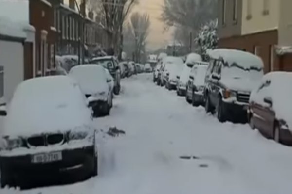
He claims that vast quantities of snow will fall by Thursday, which will disrupt road transport, public services, businesses and schools just like it did in 2010.
Cathal Nolan issued the following weather forecast on Facebook:
RED WEATHER WARNING
BLIZZARD CONDITIONS LIKELY
Please share
Having further assessed the latest run of weather models and carefully pieced together the likely physical makeup of the weather event it now looks increasingly likely that Ireland will be impacted by one of the worst spells of wintry weather since 1982.
SNOWFALL
Heavy snow will begin during Tuesday in Eastern areas and will gradually begin to effect the Midlands during Tuesday, with the snow itself likely to continue right through until Saturday. The heaviest of the snowfall looks likely to occur on Thursday and Friday, as an Atlantic storm tries to push northeastwards it will interact with the frigid air across the country and will lead to blizzard conditions as heavy snow will be accompanied by winds of between 60 and 80 kph. While it’s hard to put an estimate on the amounts of snow we may encounter from this period of time it’s certainly not beyond the realms of possibility that some areas of the Midlands may see as much as 30-40 cm. What will make the snow even more disruptive will be its potential to drift in the strong easterly winds.

TEMPERATURE
From Tuesday right through until Sunday the temperatures across the Midlands of Ireland will remain below freezing. Day time highs on Wednesday and Thursday will range between -4 and -2 degrees Celsius. Night time lows during the period may dip to as low as -8 or -10 degrees Celsius in one or two sheltered areas.
WINDCHILL
Sub zero temperatures will feel even colder given the strength of the winds and will actually feel more like -6 to -10 during Thursday and Friday in particular when we see the strongest of the winds.
LIKELY IMPACTS
Given the the vast quantities of snow which have the potential to fall it’s highly likely that severe disruption will occur in all areas of the Midlands and East of the country during the second half of next week. By Thursday I do believe that most schools in the Midlands will be closed, as well as most universities also. Road travel will grind to a halt due the quantities of snow, with even motorways likely to become impassable if the worst of the weather does develop as forecast. Businesses are likely to close right across the region also due to the lack of transport options.
This truly has the potential to become an extreme weather event and with that in mind I have taken the precautionary measure of issuing a Red Weather Warning, which I believe will be issued by the National Authorities at some point next Wednesday, a little to late as ever in order to give people adequate time to prepare sufficiently.
I will continue to keep you updated during this period.
Kindest regards,
Cathal Nolan
Please share this information with your friends and make them aware of the snow.