
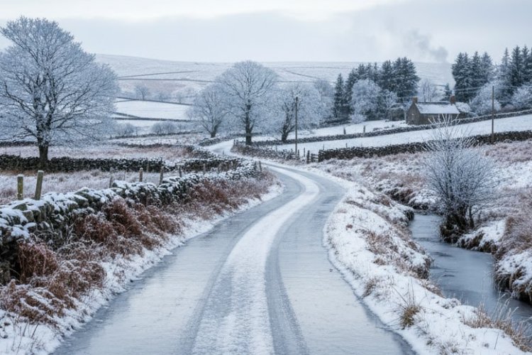
Temperatures are expected to fall to around -4C in many areas throughout the country this weekend, with several warnings issued for snow, ice and low temperatures, reports RTE.
The warnings will begin taking effect this evening and will remain in place until Sunday.
Met Éireann has highlighted the risk of dangerous driving conditions and reduced visibility.
The initial warning will activate at 8pm this evening, when a Status Yellow snow and ice alert for Donegal will remain active until 11am tomorrow.
Senior forecaster Gerry Murphy has indicated that 2cm to 3cm of snow may accumulate in parts of north Connacht and Ulster.
Mr Murphy stated that the snowfall will not be “exceptionally heavy”, but some wintry showers may fall as snow in northern counties, reports RTE.
Speaking on RTÉ’s Today with Claire Brock, he said while the snow might not be exceptionally heavy, accumulations could build on higher ground.
Mr Murphy noted that a widespread frost is expected tonight as temperatures fall to around -2 degrees Celsius, with conditions becoming increasingly colder nationwide over the weekend, reports RTE.
Daytime temperatures tomorrow are forecast to range between 1C and 5C, with overnight lows reaching around -4C.
A Status Yellow low temperature and ice warning will apply from 6pm tomorrow until 11am on Sunday for Munster, Carlow, Dublin, Kildare, Kilkenny, Laois, Longford, Meath, Offaly, Westmeath, Wexford and Wicklow.
Temperatures are set to drop to between -4C and -2C overnight, bringing sharp or severe frost and icy patches.
A separate Status Yellow snow and ice warning for Cavan, Donegal, Monaghan, Connacht and Louth will take effect from 6pm tomorrow and continue until 11am on Sunday, reports RTE.
Mr Murphy advised drivers to stay alert to road conditions, as black ice may form in places, especially on untreated surfaces.

“On some of the minor roads, the conditions will be possibly treacherous.”
As people return to work and school on Monday, Mr Murphy recommended allowing extra time for potential ice and minor snow accumulations, reports RTE.
“Monday itself will be a very cold day with some showers across the country, further to the west and north once again.
“As people get back on the roads on Monday morning, they will need to account for the fact that there will be ice in places, possibly some small amounts of lying snow in the west and north,” he said.
Northern Ireland faces multiple warnings for snow and ice throughout the weekend.
The PSNI reported that overnight poor weather created hazardous conditions this morning in certain areas, as not all roads had been treated, reports RTE.
Meanwhile, motorists have been advised to prepare for an increase in vehicle breakdowns on Monday, with AA Roadwatch highlighting the risk of battery failure in cars left idle over Christmas.
A spokesperson said: “Cold weather puts extra strain on older or weakened batteries, which is why we typically see a spike in call-outs at this time of year.”
The AA is urging drivers to inspect their vehicles over the weekend and “make sure the battery is holding charge, especially in older vehicles or those with older batteries, which are far more likely to fail in cold conditions”, reports RTE.
In the UK, certain regions have recorded up to 10cm of snow as bitterly cold conditions are set to persist across the weekend.
A series of yellow weather warnings for snow and ice are active, with the most recent extending into Monday, while amber snow warnings for northern Scotland remain until midday tomorrow.
At Loch Glascarnoch in the Scottish Highlands there was in excess of 8cm of lying snow this morning, while Aboyne in Aberdeenshire had around 9cm of lying snow.
Forecasters have cautioned that snow accumulations could reach up to 20cm on low ground and up to 40cm on higher ground, reports RTE.
The amber cold health alert means that the weather is expected to have severe impacts across health and social care services.
Tell us your thoughts in the Facebook post and share this with your friends.

