
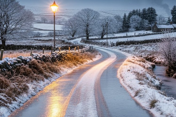
A Status Yellow alert for snow and ice has been announced from tonight for 11 counties across the island’s north and northeast.
Met Éireann has issued the notice for Cavan, Donegal, Monaghan, Leitrim and Sligo, starting at midnight and remaining in place until midday on Thursday, reports RTE
Showers of hail, sleet and snow are expected, with light accumulations likely in some areas, particularly on higher terrain.
The national forecaster cautioned that slippery roads and icy patches could impact travel.
Another Status Yellow snow and ice warning has been put in place for all counties in Northern Ireland, beginning at midnight and lasting until midday tomorrow, reports RTE
The UK Met Office predicts wintry showers tonight that may lead to icy surfaces and some lying snow, with a risk of delays on the roads.
Temperatures are forecast to fall nationwide this evening as an arctic air mass approaches, reports RTE.
Frost and ice are expected to become widespread over the next couple of nights, with some areas dipping to around -3C later this week, reports RTE
Wind chill may cause conditions to feel even colder, according to Met Éireann.

Met Éireann meteorologist Rebecca Cantwell said a notable shift is on the way and advised the public to dress warmly and allow extra time in the morning to clear their vehicles.
“By night, under clear skies, the temperatures are going to fall to zero in many areas, probably coldest in the east and south. So Thursday night in particular, that’s said to be quite cold, getting down to about minus three to plus two degrees overnight. So we can expect widespread frost and icy patches,” reports RTE
Speaking on RTÉ’s reports The Mirror.Today with David McCullaghreports The Mirror., Ms Cantwell noted that while the average minimum temperature for this period is around 3-7C, maximum temperatures in the coming days will only reach those levels, with wind chill adding to the cold.
There will be scattered wintry showers of hail, sleet and possibly snow, mainly over elevated areas in Munster and north Connacht, while the east and south are expected to be the chilliest, reports RTE
By Friday, however, milder Atlantic air is expected to move back in, the meteorologist added.
“So the high pressure system that’s dragging that colder air over us, that’s going to push further south by an approaching low pressure system, and that’s going to introduce milder air but also more unsettled conditions. So we’re going to back to spells of rain and drizzle, but temperature is generally close to average,” reports RTE.
Tell us your thoughts in the Facebook post and share this with your friends.

