
Industrial and infrastructure projects across Ireland are under increasing pressure to deliver faster timelines, tighter budgets, and higher safety standards.
From road development to large-scale construction and energy assets, decision makers are expected to operate with precision while minimizing risk. This shift has made drone services in Ireland a practical solution rather than a niche add-on.
Traditional inspection and monitoring methods often rely on manual surveys, heavy equipment, and time-consuming reporting cycles. These approaches can slow down progress and introduce avoidable safety concerns. In contrast, aerial data collection provides immediate visibility across complex sites.
This article explores how drone technology is reshaping industrial operations, highlights common challenges, and outlines practical ways businesses can integrate smarter workflows using drone services for construction in Ireland and beyond.
Why Irish Infrastructure Projects Are Turning to Drone Solutions
Infrastructure development in Ireland is accelerating, driven by urban expansion, renewable energy projects, and transport upgrades. With this growth comes the need for better data, faster decision-making, and improved coordination among on-site teams.
Historically, site inspections required scaffolding, shutdowns, or manual climbing, all of which added cost and risk. Modern drone applications offer a safer, more efficient alternative, enabling teams to capture accurate visuals without disrupting operations.
As industries move toward digital transformation, the ability to collect, process, and act on real time data is becoming essential. Drone mapping, aerial inspections, and site monitoring are now central to improving productivity and maintaining compliance.
Poor Planning Before Drone Deployment
One of the most common issues in industrial projects is deploying drones without a clear operational plan. Teams may invest in technology but fail to define objectives such as data requirements or reporting formats.
Without proper planning, collected data becomes difficult to interpret or integrate into existing workflows. This leads to wasted time and reduced return on investment for drone operations.
A structured approach should include defining inspection goals, mapping flight paths, and aligning outputs with project requirements. This ensures drone data supports decision-making rather than adding complexity.
Ignoring Regulatory Requirements
Ireland has strict aviation regulations governing drone operations, particularly in industrial and urban environments. Ignoring these rules can result in fines, project delays, or safety risks.
Many companies underestimate the importance of compliance, including pilot certification and flight permissions. This creates unnecessary exposure for businesses operating in sensitive or high-traffic areas.
Working with licensed drone service providers in Ireland ensures compliance with aviation authorities. It also guarantees that operations meet safety and legal standards from the outset.
Inconsistent Data Collection Methods
Consistency is critical when using drones for monitoring or inspections. Inconsistent flight paths, camera angles, or data capture intervals can lead to unreliable comparisons over time.
For example, construction progress tracking requires consistent datasets to accurately measure changes. Without consistency, reports lose credibility and cannot support informed decisions.
Standardizing data collection procedures, including flight planning and image capture settings, helps maintain accuracy. This is particularly important for long term infrastructure projects.
Overlooking Data Processing and Analysis
Collecting aerial data is only part of the process. Many organizations struggle with turning raw images into meaningful insights that can guide project decisions.
Without proper analysis tools, teams may end up with large volumes of data that are difficult to interpret. This limits the value of drone technology and slows down reporting.
Professional drone service providers typically include data processing, mapping, and reporting as part of their offering. This ensures that insights are actionable and aligned with project goals.
Limited Integration with Existing Workflows
Another challenge is the lack of integration between drone data and existing project management systems. When data sits in isolation, it fails to support broader operational efficiency.
Construction managers, engineers, and stakeholders need access to clear and accessible information. Disconnected systems create delays and reduce collaboration across teams.
Integrating drone outputs with BIM models, GIS platforms, and reporting tools enhances visibility. This is where drone services for construction in Ireland deliver the most value.
Underestimating Safety Benefits
Safety is often viewed as a secondary benefit rather than a primary driver for drone adoption. This mindset can prevent organizations from fully leveraging the technology.

Manual inspections of roofs, bridges, or industrial assets expose workers to significant risks. Drones eliminate the need for physical access in many of these scenarios.
By prioritizing safety, companies can reduce incidents, lower insurance costs, and improve overall site conditions. This makes drone adoption a strategic decision rather than a technical upgrade.
Choosing Inexperienced Service Providers
Not all drone operators deliver the same level of expertise. Inexperienced providers may lack industry knowledge, leading to poor data quality or incomplete inspections.
This can result in missed defects, inaccurate measurements, or unreliable reports. In critical infrastructure projects, these issues can have serious consequences.
Selecting experienced providers with a proven track record in industrial applications ensures reliable results. It also brings valuable insights that improve project outcomes.
Real World Examples and Case Studies
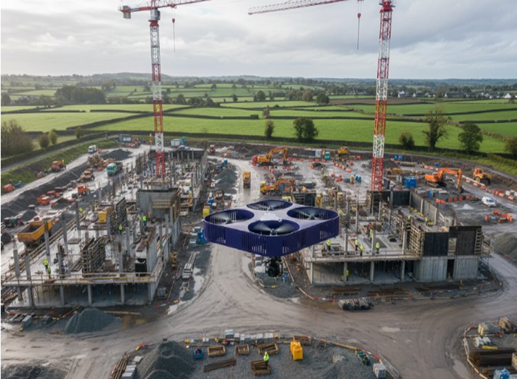
Across Ireland, drone technology is already delivering measurable improvements in industrial and infrastructure projects. In large-scale construction sites, aerial mapping has enabled teams to track progress weekly, reducing reporting time significantly.
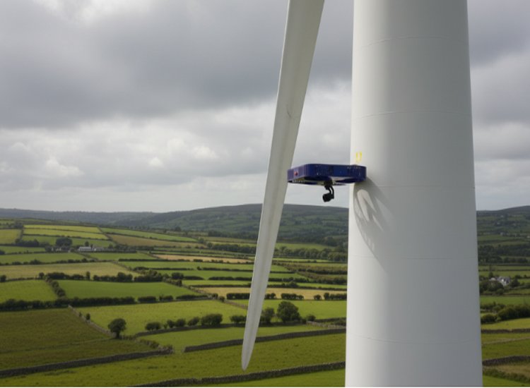
In the energy sector, wind farm inspections using drones have replaced manual climbing, improving safety while capturing high resolution imagery of turbine components. This approach has helped identify maintenance issues earlier and reduce downtime.
Agricultural operations have also benefited from drone surveys, allowing farmers to monitor crop health and optimize resource use. These examples highlight the versatility of drone services in Ireland across multiple industries.
Visual outputs such as orthomosaic maps, 3D models, and inspection imagery provide clear evidence for stakeholders. These deliverables support better communication and faster decision making.
Best Practices and Professional Checklist
Successful implementation of drone technology requires a structured and practical approach. Organizations should focus on planning, execution, and continuous improvement.
Best Practices Checklist:
- Define clear project objectives before deployment
- Ensure compliance with Irish aviation regulations
- Use standardized flight plans for consistency
- Integrate drone data with existing systems
- Prioritize safety in all operations
- Work with experienced and certified providers
- Validate data accuracy through regular checks
Combining drone insights with traditional engineering expertise creates a balanced approach. This hybrid model ensures both innovation and reliability in project delivery.
Limitations and Future Trends
Despite its advantages, drone technology does have limitations. Weather conditions in Ireland can impact flight schedules, and certain environments may restrict operations.
Battery life and payload capacity also limit the duration and scope of some missions. These constraints require careful planning to ensure efficient resource use.
Looking ahead, advancements in sensor technology, automation, and data analytics are expected to enhance capabilities. Integration with digital twins and real-time monitoring systems will further strengthen drones’ role in infrastructure projects.
FAQs
How accurate are drone surveys in industrial projects?
Drone surveys can achieve high levels of accuracy when proper flight planning and ground control points are used. This makes them suitable for mapping and measurement tasks.
Are drone operations legal across all project sites in Ireland?
Drone use is regulated, and certain areas require permission. Working with compliant providers ensures operations meet all legal requirements.
What industries benefit most from drone services?
The construction, agriculture, energy, and infrastructure sectors benefit significantly from the need for inspections, mapping, and monitoring.
Can drones replace traditional inspection methods?
Drones complement traditional methods rather than fully replacing them. They reduce risk and improve efficiency but may still require follow-up inspections.
How can companies improve drone data quality?
Consistency in data collection, proper calibration, and professional processing all contribute to higher quality outputs.
Conclusion
The growing complexity of industrial and infrastructure projects in Ireland demands smarter and more efficient solutions become essential as projects grow in scale and complexity. Aerial technology offers a practical way to improve safety, reduce costs, and support faster, better decision-making across different industries.
By following proven methods and working with experienced professionals, businesses can get real value from this approach. From construction sites to agricultural land, the advantages are visible in both day-to-day operations and long-term results.
For organizations aiming to stay competitive, adopting smarter site monitoring and inspection methods is no longer optional. It has become a necessary step toward delivering projects with greater accuracy, efficiency, and confidence.

