
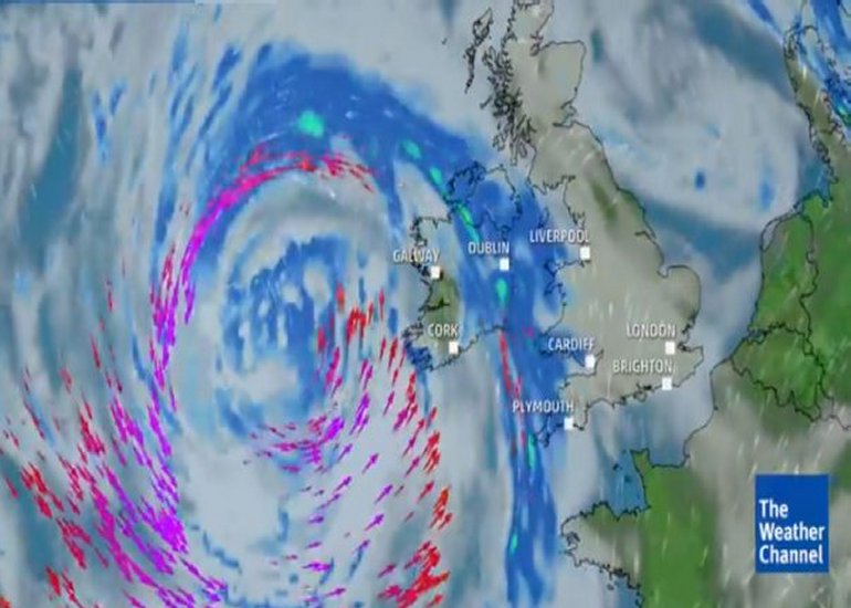
Ireland is currently experiencing severe rain and winds and Chandra, a low-pressure system named by the UK Met Office, which began affecting the country from last night and will remain until tomorrow.
The storm tracks northwards across Ireland, bringing strong to gale-force winds and heavy rainfall. Gusts reach up to 120 km/h in exposed areas and along coasts, with easterly to southeasterly directions initially, shifting later. A Status Yellow wind warning covers the entire country until 11pm on Tuesday.

Heavy rain has fallen on already saturated ground, leading to localised flooding in various regions, including parts of Dublin such as Rathfarnham. Rainfall totals vary, with higher amounts possible on elevated terrain. Heavy or prolonged showers follow the initial outbreaks as the system moves north.
Impacts include hazardous travel conditions on roads, potential disruptions to public transport, and risks of power outages from downed lines or fallen trees. Some northern areas have seen snow on higher ground.
At least 7,000 properties are now without power with that number expected to rise significantly over the coming hours.
Conditions are expected to gradually ease later on Tuesday and into Wednesday, with winds moderating and clearer spells developing, though showers persist in western and southern regions. Temperatures remain mild, ranging from 1–5°C overnight to 7–10°C during the day.
People are advised to stay indoors if at all possible while the storm passes.
Tell us your thoughts in the Facebook post and share this with your friends.

