
To meet the definition of a heatwave, temperatures of 25°C or above must be recorded at a single location for at least five consecutive days.
On Tuesday, Oak Park Weather Station in Co Carlow recorded a peak of 28.1°C, while temperatures across parts of the country were expected to hit 27°C yesterday, reports RTE.
Met Éireann meteorologist Aoife Kealy said yesterday that a heatwave was still a possibility, but slightly lower temperatures today might prevent Ireland from meeting the required threshold. The south and southeast are expected to experience the warmest weather, with temperatures potentially reaching 25°C.

Today is forecast to begin cloudy, with scattered showers—some of which could be heavy. As the day progresses, showers will mainly affect the midlands, north, and east, and brighter, sunnier intervals are likely to develop later on, reports RTE.
According to Met Éireann, the weather will stay mild and humid, with daytime temperatures ranging between 19°C and 25°C.
Separately, a Yellow thunderstorm alert will remain in place until 10pm for counties Antrim, Armagh, Down, Fermanagh, Tyrone, and Derry, reports RTE.
The Met Office has warned that although some areas may avoid rain, intense showers and thunderstorms could lead to disruption.
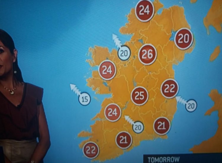
Warm conditions are forecast to persist tomorrow and into the weekend, with temperatures expected to stay in the mid-20s range, reports RTE.
On the question of whether a high temperature warning might be issued, Ms Kealy noted that current forecasts suggest such a warning is unlikely.
To trigger a high temperature warning, temperatures must reach over 27°C and affect a broad region, reports RTE.
Tell us your thoughts in the Facebook post and share this with your friends.

